Smith Heritage Surveyors
About Our Drone Surveys
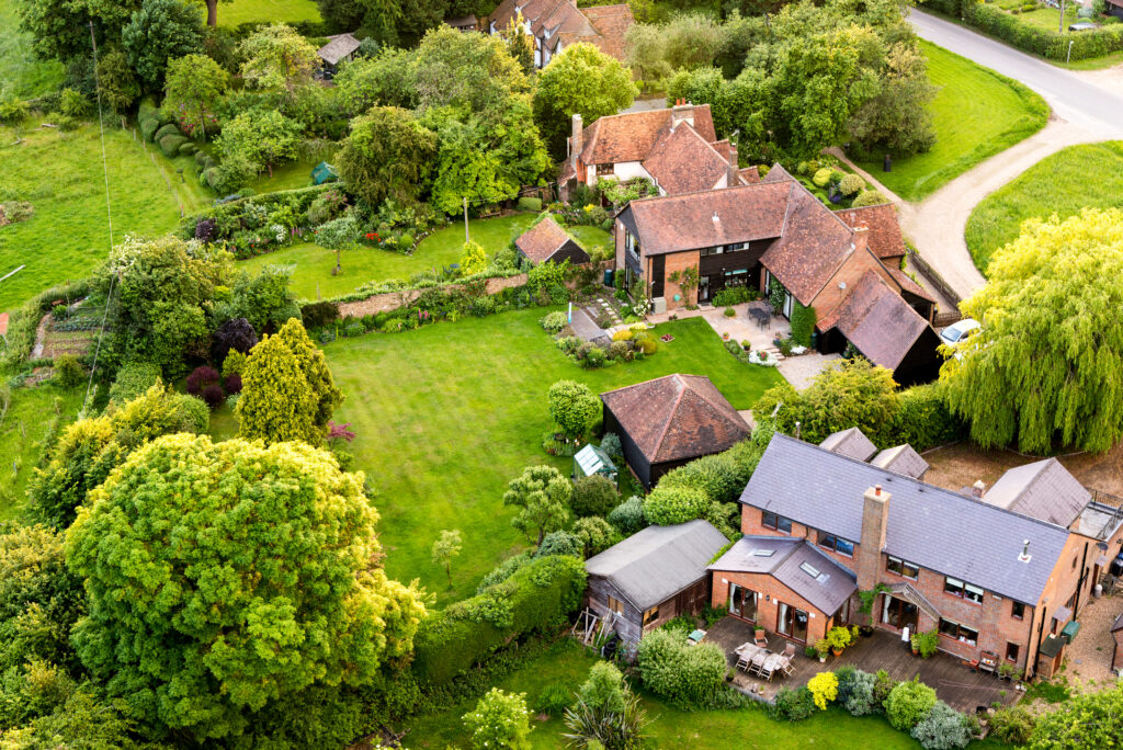
Get an aerial view of your property with our expert drone survey service. Our experienced surveyors use the latest technology to provide high-quality images and data, helping you to identify potential issues and make informed decisions.
Contact us today to learn more about how we can help you with your property survey needs

Smith Heritage Surveyors
What’s included in a Drone Survey?
- Thorough aerial inspection of your property using the latest drone technology
- Detailed report of all findings, including images to illustrate any defects found
- Fully licensed drone operator and chartered surveyor to carry out the survey
- Bank of high-quality aerial photography of your buildings for personal use

Start your project
Book a Drone Survey
Do you need to inspect a high-level, hard-to-reach area of your property? Smith Heritage Surveyors can help. We carry out quality Drone Surveys across the South of England and Wales to help you manage even the most complex of buildings.
Get your project started and book a Drone Survey with Smith Heritage Surveyors today.
Our portfolio
Drone Survey case study
Drone Survey Reveals Hidden Damage to Roof of Residential Property
Our team was engaged to carry out a drone survey on a residential property located in a rural area. The client had noticed some water damage on the ceiling inside the property and was concerned that there might be damage to the roof.
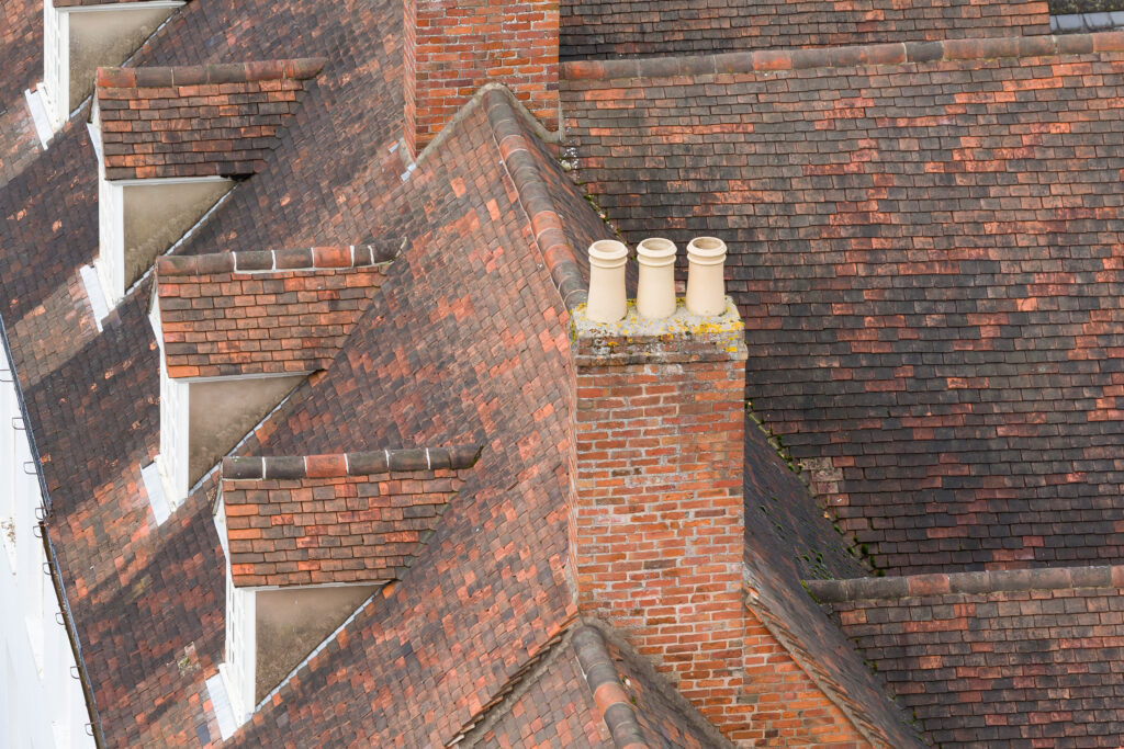
Our experienced surveyors used a drone equipped with high-resolution cameras to capture detailed images of the property’s roof. The images revealed extensive damage to the roof tiles and guttering, which was not visible from the ground.
We provided the client with a comprehensive report that included the high-quality images captured during the survey and recommendations for remediation. The client was able to use this report to work with a roofing contractor to carry out the necessary repairs.
Thanks to the drone survey, the client was able to identify the hidden damage to their property’s roof before it caused more serious issues such as leaks or water damage. The survey also allowed the client to take action and make informed decisions regarding the necessary repairs.
This case study highlights the value of using drone surveys to identify issues that may not be visible from the ground. By using the latest technology, our expert team was able to provide the client with high-quality images and data that helped them to make informed decisions regarding the maintenance and repair of their property.
The drone survey also helped to save the client time and money, by identifying the damage before it became more serious and potentially more expensive to repair.

A Full Guide to Drone Surveys
Require a high level survey: Key elements to consider
- Increased safety: Drones can survey roofs from a safe distance, reducing the need for workers to physically inspect the roof and reducing the risk of injury or damage to the property.
- Cost savings: Using a drone for roof inspections can be less expensive than traditional inspection methods, as it eliminates the need for scaffolding or cherry pickers, which can be costly to hire and set up.
- Speed and efficiency: Drones can survey roofs quickly and efficiently, reducing the amount of time needed for inspections and allowing for multiple inspections in a single day.
- Improved accuracy: Drones equipped with high-resolution cameras and other sensors can capture detailed images and data, allowing for a more accurate assessment of the roof’s condition.
- Increased accessibility: Drones can survey roofs that are difficult to access, such as those on high buildings or in remote locations, without the need for specialized equipment or personnel.
Overall, using a drone to survey a roof can provide a faster, more efficient, and safer way to inspect and assess the condition of a roof, while also providing detailed and accurate information.
Drone surveys are used for a variety of purposes, including:
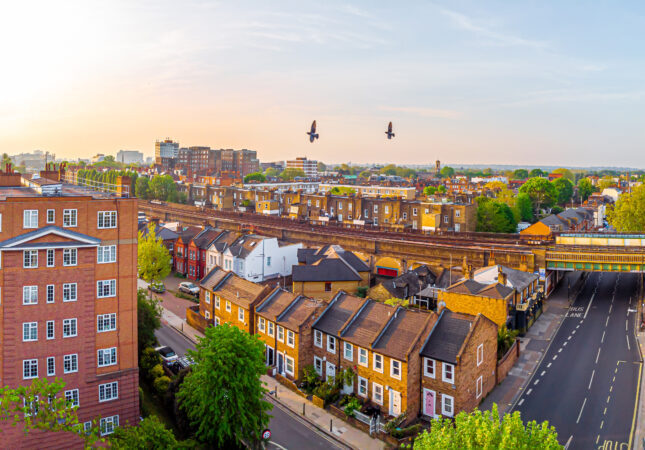
- Land and property surveys: Drone surveys can provide accurate and detailed aerial imagery of land and property, including buildings, roads, and other structures, making it easier to assess property conditions and to plan new developments.
- Agricultural surveys: Drone surveys are commonly used in agriculture to assess crops, monitor soil moisture levels, and detect crop health issues.
- Construction site inspections: Drone surveys can be used to inspect construction sites, providing an aerial view of the progress of the construction work and identifying any potential safety hazards.
- Surveying and mapping: Drone surveys are used for topographical mapping, providing high-resolution aerial imagery and data for use in land-use planning and mapping applications.
- Environmental surveys: Drone surveys can be used to monitor environmental conditions, including wildlife populations, land degradation, and other environmental issues.
- Disaster response: Drone surveys can be used to assess the damage caused by natural disasters, such as hurricanes, earthquakes, and floods, helping first responders and relief workers to quickly understand the extent of the damage and prioritize their efforts.
- Infrastructure inspections: Drone surveys can be used to inspect large infrastructure projects, such as bridges, power lines, and pipelines, providing an aerial view of the structures and allowing for early identification of any potential safety hazards or maintenance needs.
Overall, drone surveys are a versatile and efficient tool for capturing high-resolution aerial imagery and data, making them useful for a wide range of applications in fields such as construction, agriculture, environmental management, and more.
In general, the cost of a drone survey in the UK can range from a few hundred to several thousand pounds, depending on the specific requirements of the project. For a small-scale survey, such as a survey of a single building or a small plot of land, the cost may be in the region of a few hundred pounds. For larger and more complex surveys, such as a large-scale land survey or a construction site inspection, the cost can be several thousand pounds.
It’s important to keep in mind that drone surveys are just one component of the overall cost of a project and that other costs, such as data processing, analysis, and report preparation, may also need to be taken into account. To get a more accurate estimate of the cost of a drone survey, it’s best to get in touch and ask for a quote based on your specific needs.
Speak to Smith Heritage
Contact us today
To request a quote or enquire about any of our services, get in touch with the Smith Heritage team today.